Showing 101-120 of 683 Entries
Author: James K. Nelsen
The City of Brookfield is located in the northeast corner of Waukesha County. It is north of New Berlin, south of Menomonee Falls, and east of Pewaukee. According to the U.S. Census, the City of Brookfield had almost thirty-eight thousand residents in 2010. Its elected officials include a common council of fourteen alderpersons and a…
Read More
Author: Michael Pulido
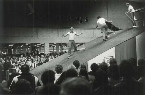
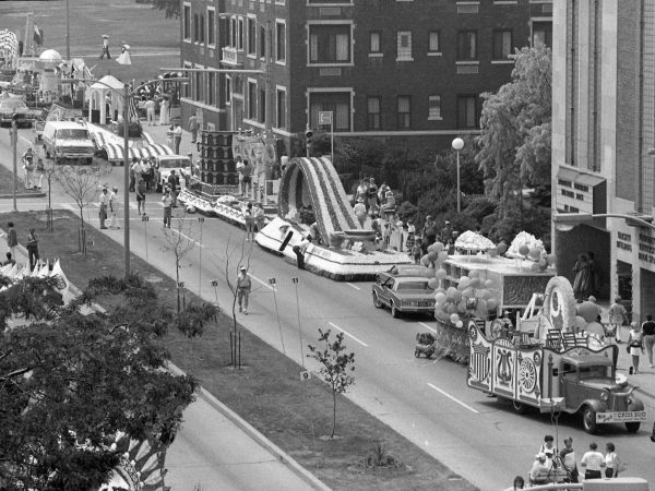
Inspired after witnessing the parade and pageantry that commences Munich’s Oktoberfest, Mayor Henry Maier envisioned something similar to kick off Milwaukee’s festival season. Beginning in 1983, the City of Festivals Parade opened Milwaukee’s summer festivals and celebrated the city’s ethnic diversity. Every June, high school bands and floats featuring ethnic dances and musicians wound their…
Read More
Author: Phyllis Santacroce
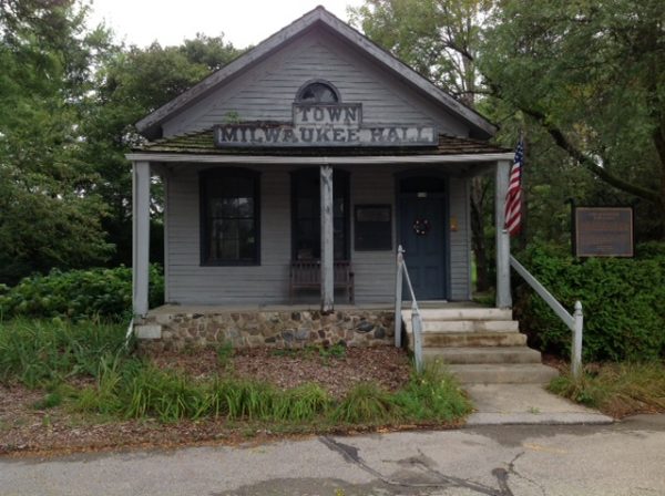
Glendale, Wisconsin, is an inner ring suburb just north of Milwaukee that was carved from the remains of the old Town of Milwaukee. When incorporated in December 1950 at the leading edge of a postwar suburban wave, Glendale included 3,152 residents in a strangely shaped area that stretched east of the Milwaukee River and west…
Read More
Author: Jenna Jacobs
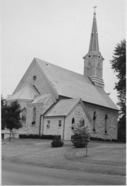
The City of Mequon, located north of MILWAUKEE, forms the southern border of OZAUKEE COUNTY. Encompassing over forty-eight square miles, Mequon extends from LAKE MICHIGAN to WASHINGTON COUNTY and surrounds the VILLAGE OF THIENSVILLE. Incorporated in 1957, the City retains many rural traits such as low population density and undeveloped properties. The land that became…
Read More
Author: James K. Nelsen
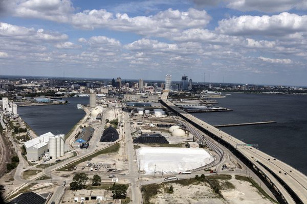
According to the 2010 census, the City of Milwaukee was the largest city in the State of Wisconsin, with 594,738 residents. It was ranked thirtieth most populous city in the United States in 2012. It has grown from seven square miles in area in 1846 to 96.8 square miles. Milwaukee has a mayor-council form of…
Read More
Authors: Larry Rowe and Anita Rowe
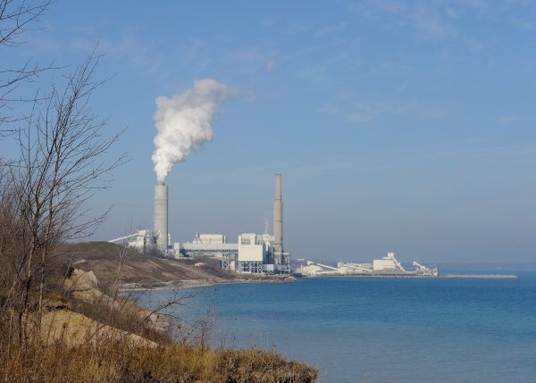
Oak Creek’s historical development was similar to many other suburban communities. But its incorporation effort in the early 1950s resulted in a change to Wisconsin state law that transformed the Milwaukee area’s municipal landscape. The first town meeting in Oak Creek took place on April 5, 1842, when an estimated forty families lived in the…
Read More
Author: William I. Tchakirides
The City of Pewaukee is located approximately seventeen miles west of Milwaukee in WAUKESHA COUNTY. It surrounds the independently governed VILLAGE OF PEWAUKEE, which in 1876 voted to separate from the Town of Pewaukee (initially established by the Wisconsin Territorial Legislature in 1840). Self-promoted as “The City in the Country,” the sprawling City of Pewaukee…
Read More
Author: Richard Smith
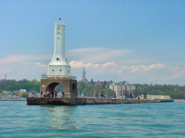
The City of Port Washington was first founded in 1835 as part of an expansion of American interests into lands controlled by the French and British prior to the War of 1812. The area was largely settled by members of the Potawatomi tribe prior to 1835. There was a large village approximately three miles inland…
Read More
Author: Christopher Mark Miller
South Milwaukee was incorporated as a village on November 8, 1892, following in the footsteps of Whitefish Bay and Wauwatosa, which both incorporated earlier that year. Located along the shores of Lake Michigan and the banks of the Oak Creek, the new village included the Oak Creek settlement, which dated back to the 1840s. A…
Read More
Author: Katie Steffan
At 2.55 square miles, the City of St. Francis is one of the smallest suburbs by area in MILWAUKEE COUNTY. According to early white settlers, native residents called the area “Nojoshing,” possibly meaning “strip of land extending into the water.” When the territorial government divided Milwaukee County into townships, Nojoshing became part of the Town…
Read More
Author: Pilar Melero
“Wi-saka” does not adorn the gate of any park, or the entrance to a school. However, the Potawatomi people who inhabited Waukesha and surrounding areas before European arrival know the name well. Potawatomi oral tradition calls Wi-saka “the Great Spirit” and credits him with the creation of the world. The naming of modern-day Waukesha, though,…
Read More
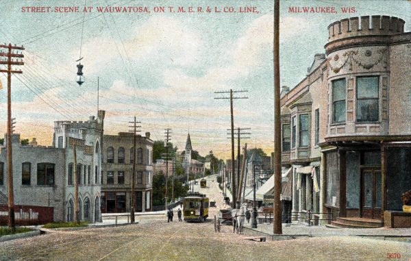
Author: James K. Nelsen
Wauwatosa is a city in the western portion of Milwaukee County. It is immediately east of the City of Brookfield and the Village of Elm Gove, both in Waukesha County. It shares a tiny section of its southwestern border with the City of West Allis but is otherwise surrounded by the City of Milwaukee. According…
Read More
Author: James K. Nelsen
West Allis is a city in Milwaukee County, nestled against the City of Milwaukee’s western boundary. According to the 2010 census, it had a population of 60,411, which makes West Allis the eleventh most populous municipality in Wisconsin and the third most populous municipality in the four-county metropolitan area, behind only the cities of Milwaukee…
Read More
Author: John M. McCarthy
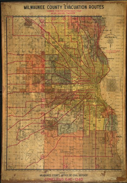
Civil defense was adopted as an important policy in postwar Milwaukee by Mayor Frank Zeidler. In 1948, fearing atomic warfare, Zeidler helped create the Civil Defense and Disaster Committee, and in 1952, city officials created the Department of Civil Defense. Milwaukee gained notoriety for comprehensive civil defense efforts which included over 3,000 volunteer “block wardens,”…
Read More
Author: William Dahlk
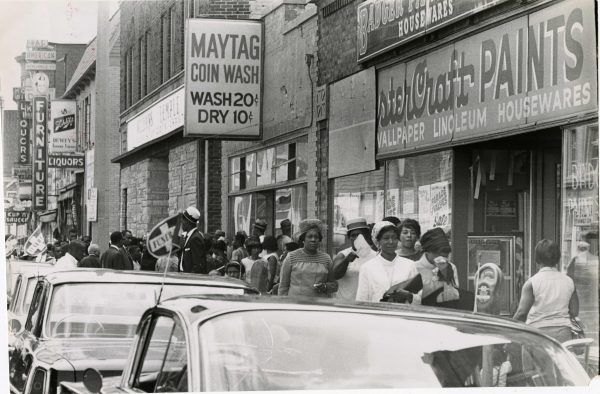
The Milwaukee civil disorder of 1967, often referred to as a riot, began on the evening of Sunday, July 30. By the following morning, confrontations on the city’s streets had essentially ended. Its brevity was the result of rapid, muscular responses by Milwaukee police, Mayor Henry Maier, and Wisconsin governor Warren Knowles, who sent in…
Read More
Author: Kevin D. Smith
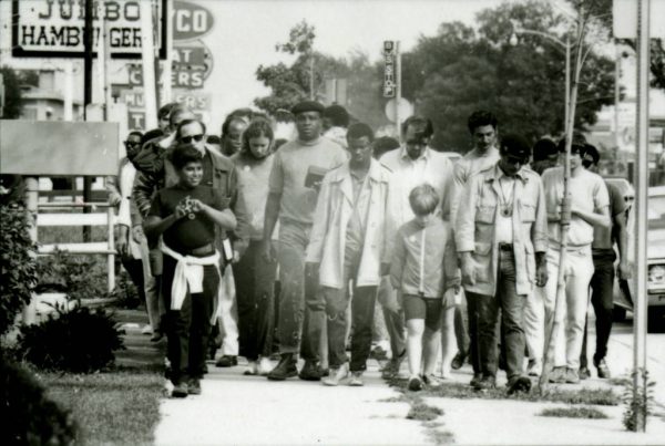
Milwaukee’s Civil Rights Movement was the culmination of longstanding efforts by African Americans, Latinos, Native Americans, and their white allies to improve social, political, and economic prospects for non-white Milwaukeeans. During the 1860s, a small group of African Americans struggled to win the franchise. With the arrival of thousands of Southern migrants during the Great…
Read More
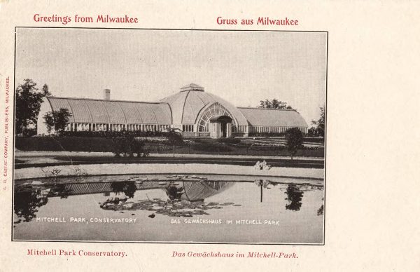
Author: Virginia Small
Clarke Square, one of Milwaukee’s most diverse, storied, and densely populated neighborhoods, dates back fifty years before Milwaukee became a city. In 1795 French-Canadian fur trader Jacques Vieau built Milwaukee’s first settler’s cabin there as part of his trading post overlooking the Menomonee Valley (a site marked in Mitchell Park). In 1819 Vieau gave the…
Read More
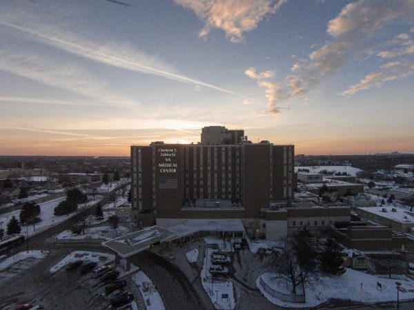
Author: James Marten
The Clement J. Zablocki VA Medical Center is the direct descendant of the Northwestern Branch of the National Home for Disabled Volunteer Soldiers (NHDVS), established by Congress in 1865 to care for Union soldiers who had suffered disabling wounds or illnesses due to their service in the Civil War. The home was funded partly by…
Read More
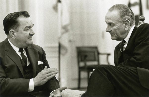
Author: Bethany Harding
Clement J. Zablocki (1912-1983) represented Milwaukee’s South Side as a Democrat in the Wisconsin state senate from 1943 to 1948 and in the U.S. House of Representatives from 1949 to 1983. Of Polish ancestry, Zablocki was a lifelong devotee of his community and his Catholic faith. He attended St. Vincent DePaul Parish School, Marquette University…
Read More
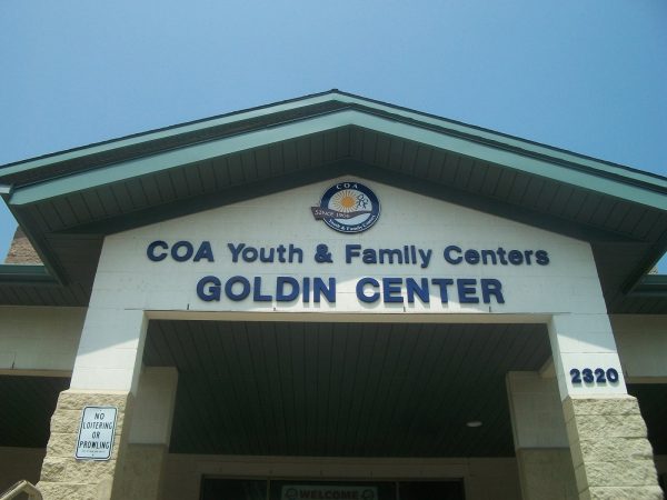
Author: Michael Gonzales
The Children’s Outing Society was formed in 1906 by Florence Friend, Elizabeth “Lizzie” Black Kander, and other women from the Personal Relief Society, a social service organization active in Milwaukee’s Jewish community. The Society changed its name to the Children’s Outing Association (COA) in 1930. COA’s initial purpose was to improve the physical well-being of…
Read More