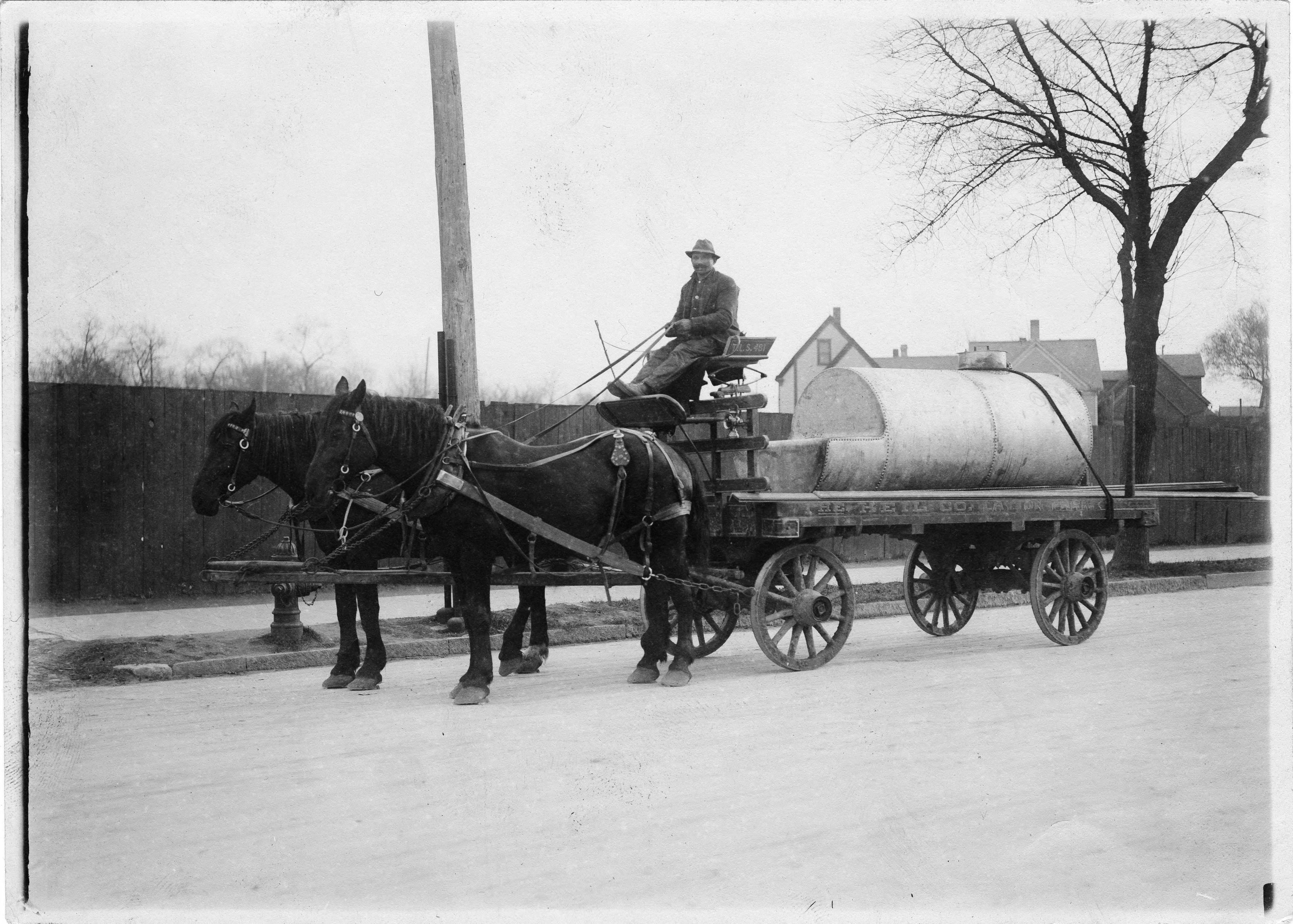
A man sits atop a horse-drawn wagon carrying a metal tank. The wagon is labelled as belonging to the Heil Company, located in the Layton Park neighborhood.
Source:
From the Roman B. Kwaniewski Photographs Collection, Archives. University of Wisconsin-Milwaukee Libraries. Link to Image Source URL
This map, copied in 1919, shows the Village of Bay View as it appeared in 1887.
Source:
From the American Geographical Society Library Milwaukee Municipal Research Library Collection. University of Wisconsin-Milwaukee Libraries. Link to Image Source URL
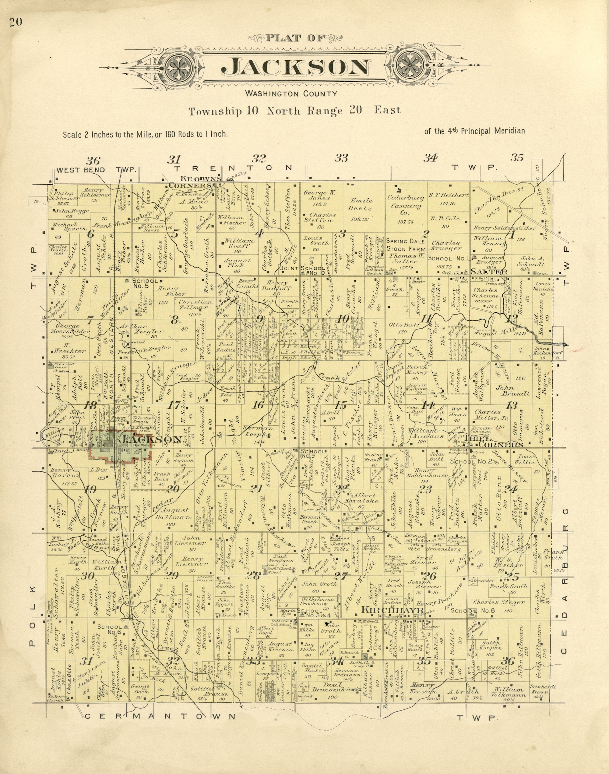
This 1915 map shows the Town of Jackson, with the Village of Jackson outlined in red, as well as the unincorporated communities of Salter, Thiel Corners, Kirchhayn, and Keowns Corners.
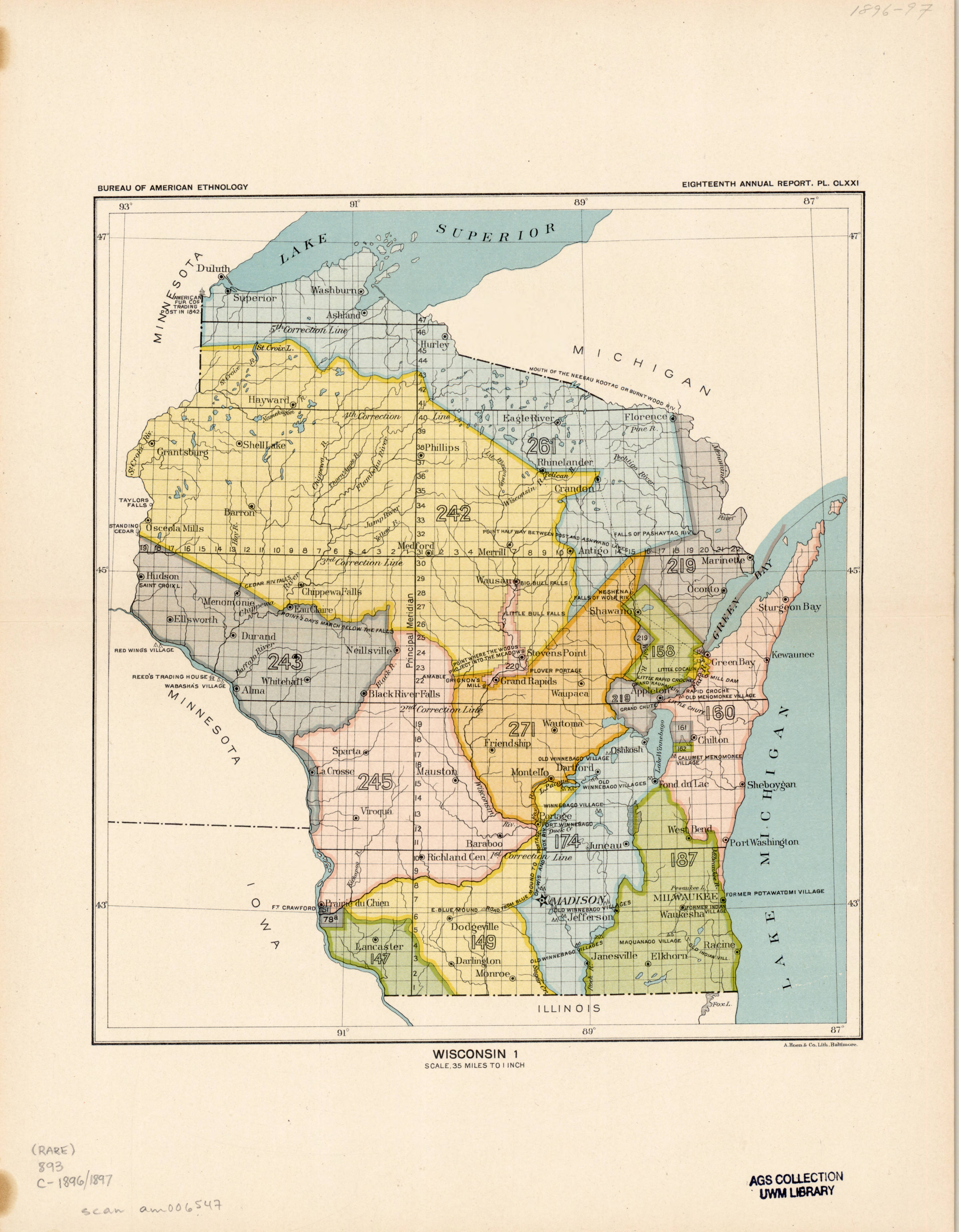
Before Milwaukee became a city, the western shore of Lake Michigan and what we know now as Southeast Wisconsin was Indian Country. In 1829, the Menominee Indians ceded the land in the pink area to the U.S. The Chippewa, Ottawa, and Potawatomi ceded the land in green area to the U.S. in 1832. Together, these land cessions reshaped the geography of the southwestern shore of Lake Michigan, and made the area we now call the Milwaukee metropolitan area United States land.
Source:
From the Eighteenth Annual Report of the Bureau of American Ethnology to the Secretary of the Smithsonian Institution, 1896-1897. Accessed via the Library of Congress. Link to Image Source URL
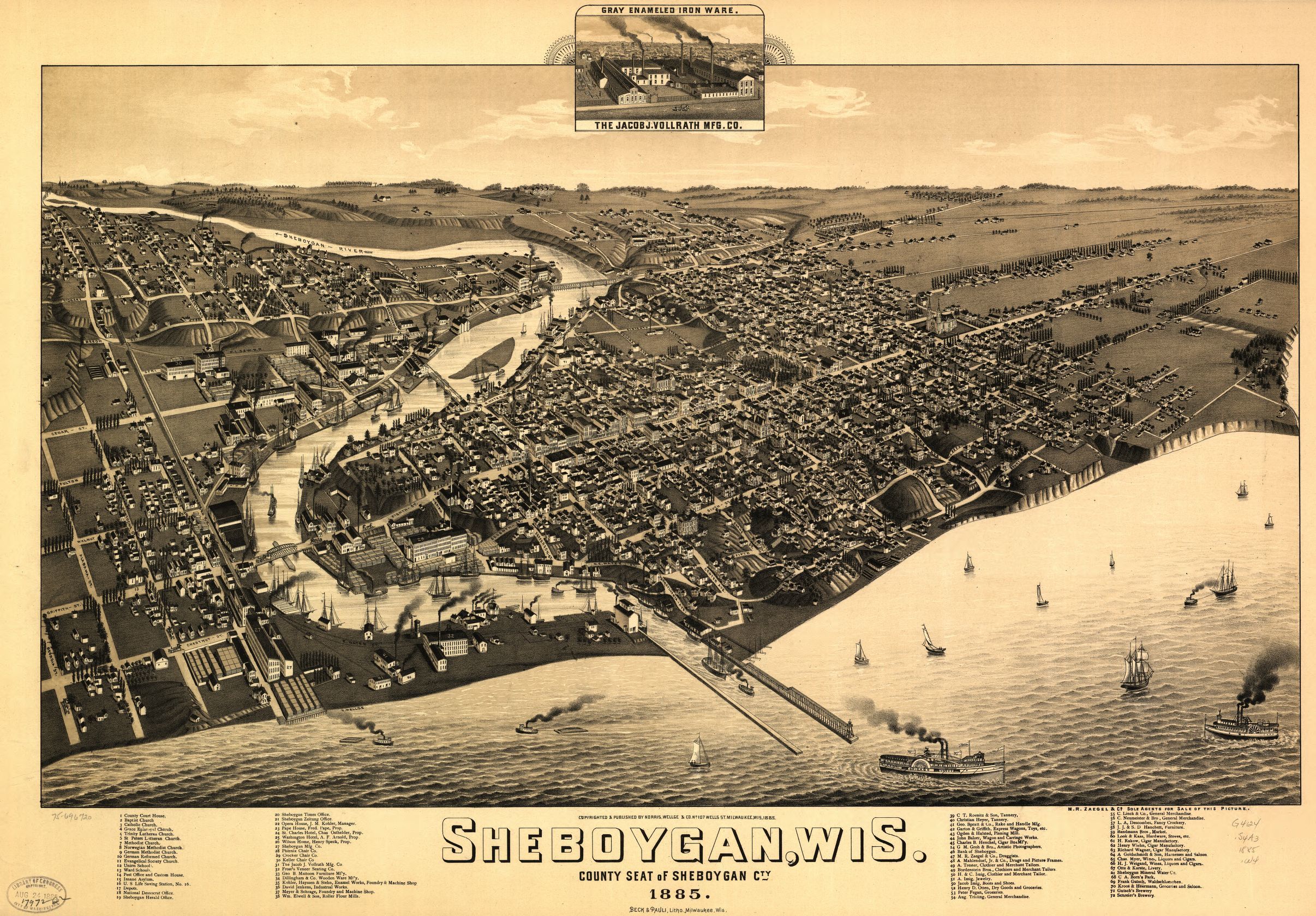
This map illustrates the city of Sheboygan as it appeared in 1885. Begun as a small village in 1836, the city grew to become the county seat of Sheboygan County.
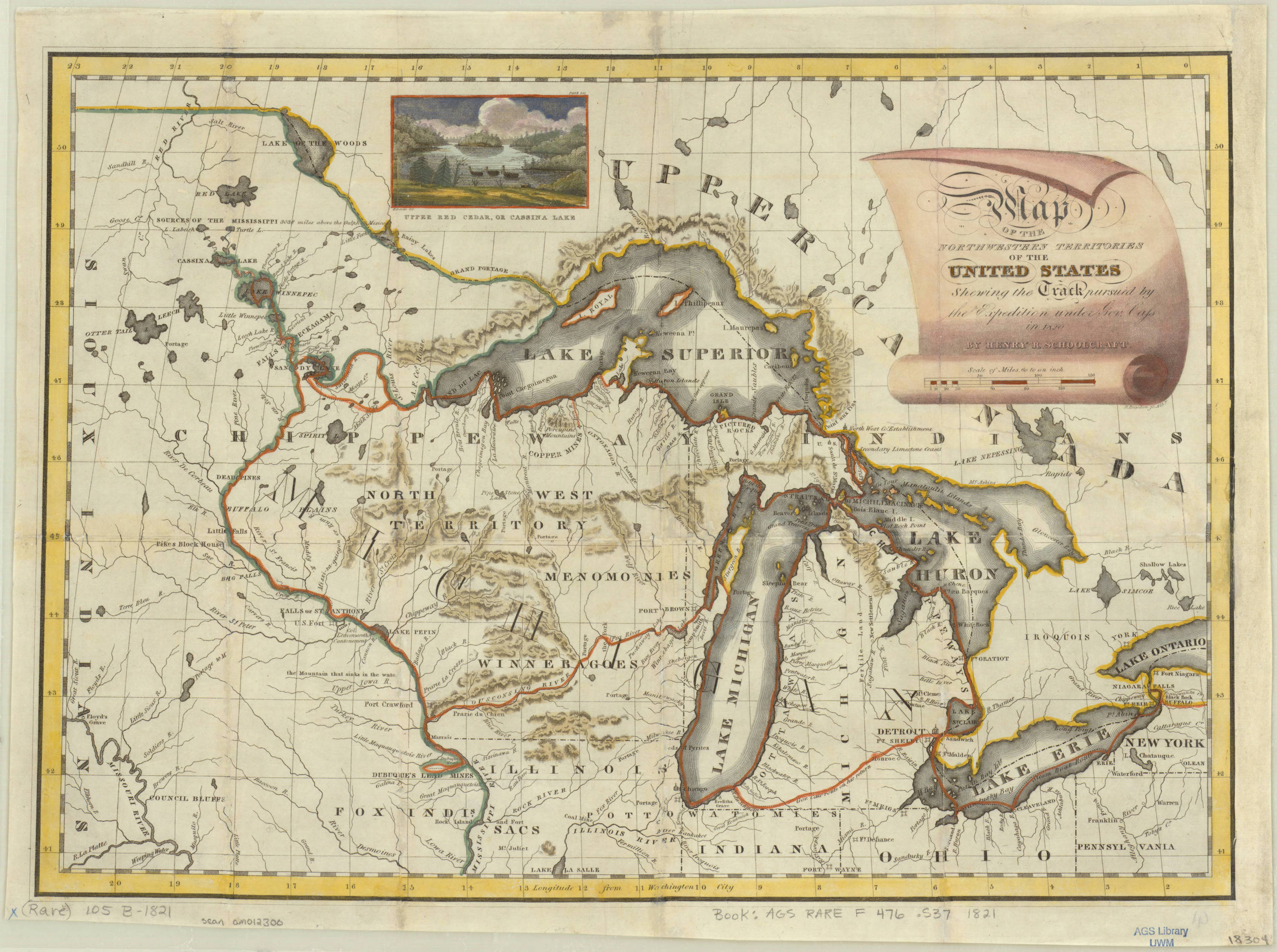
1821 map of the Great Lakes and Northwestern Territories, when Wisconsin was part of the Michigan Territory. The red lines indicate the route taken by Lewis Cass, governor of the Michigan Territory, in 1820.
Source:
From the American Geographical Society Library Digital Map Collection. University of Wisconsin-Milwaukee Libraries. Link to Image Source URL