Showing 641-660 of 683 Entries
Author: James Marten
Although the neighborhood that is now Washington Heights has not always been called such, it has long been a distinctive part of the Milwaukee area. Bounded by Wisconsin Highway 175 (formerly U. S. Highway 41) on the east, North Avenue on the North, 60th street on the west, and Vliet Street on the South, this…
Read More
Author: Jenniffer Ammerman
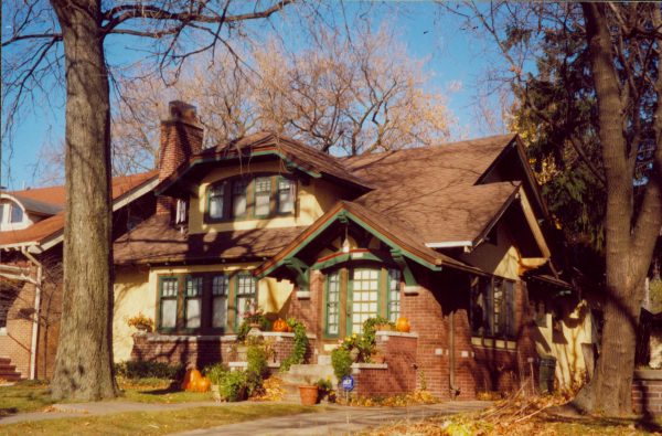
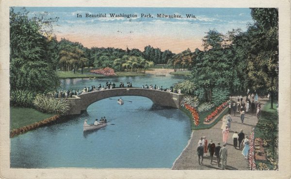
Washington Park is a residential NEIGHBORHOOD on Milwaukee’s West Side. Its landscape is dominated by the park that provides the neighborhood with its name. The neighborhood’s boundaries are North Avenue (north), West Vliet Street (south), Wisconsin Highway 175 (west), and North 35th Street (east). The neighborhood’s history is one of transition from AGRICULTURAL farmland to…
Read More
Author: John Gurda
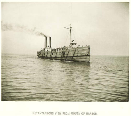
The history of Milwaukee is anything but dry. Water, in fact, runs through it like a river, constituting an element so critical that imagining the community without it is virtually impossible. Whether for transportation, industry, recreation, sanitation, or simply as the backdrop for daily life, water is the fluid medium in which Milwaukee evolved from…
Read More
Author: Kathleen Foss
Water policy in Milwaukee has evolved with both changes in scientific knowledge and federal law; as understanding of the ecological role of water systems and legal acknowledgement of hierarchical structures in the use of those systems has changed, so has the focus of Milwaukee’s water policy. Like other cities in the nineteenth century, whether extant…
Read More
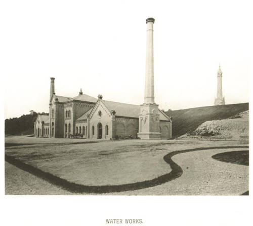
Author: Kathleen Foss
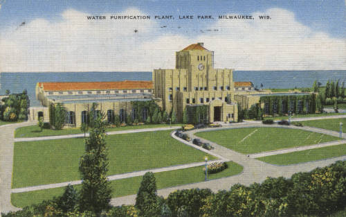
Cities supply water for domestic, industrial, and agricultural uses in response to concerns about quality and quantity. Milwaukee first implemented water supply for both domestic and industrial reasons; since then, quality and quantity demands have alternately dominated changes in the water system’s infrastructure. Water in Milwaukee was available from a private vendor as early as…
Read More
Author: Cody Schreck
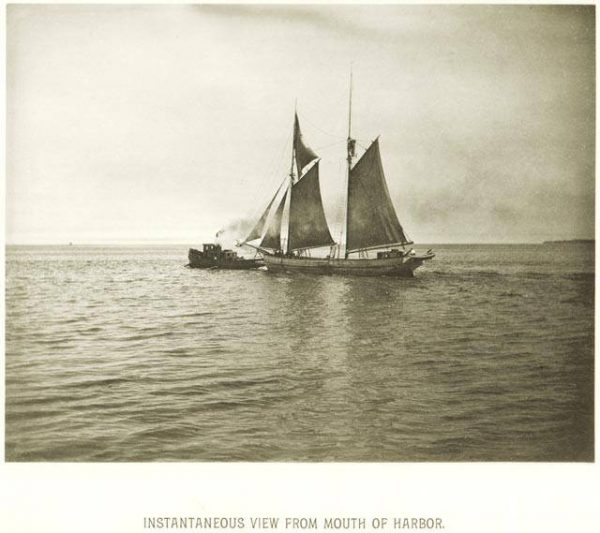
Native Americans, as the first inhabitants of the Greater Milwaukee area, were the first to use the lakes, rivers, and streams that dominate the landscape as a means of transportation. In Milwaukee in particular, they used the three connecting rivers and lakeshore as major thoroughfares for canoe travel and harvesting water-based food. Native peoples of…
Read More
Author: Michael Gonzales
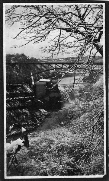
Watermills, structures that rely upon water power to drive mechanical processes, were common features in 19th century Wisconsin settler communities. The earliest of these mills were often sawmills. In addition to processing wood for export, sawmills produced lumber for local use, allowing more ambitious structures to rise alongside the early log cabins. In 1834, Dr.…
Read More
Authors: Pilar Melero and Cody Schreck
Beginning in the 1600s, France, Virginia, New York, Massachusetts, Connecticut, Indiana, Michigan, Ohio, and Illinois all claimed portions of what is now Waukesha County. Not until 1818, when the Michigan Legislature organized Brown County, did one of the most prosperous counties in Wisconsin begin to take shape. In 1834, it became part of the newly-formed…
Read More
Author: Joseph B. Walzer
Waukesha County Technical College (WCTC) is a vocational training and general education school headquartered in Pewaukee. It is part of the Wisconsin Technical College System. WCTC emerged out of the vocational education movement of the 1910s. In 1911, Wisconsin passed pioneering legislation requiring fourteen and fifteen-year-olds to attend school at least part-time (a stipulation extended…
Read More
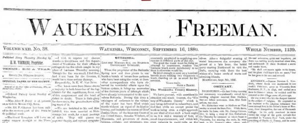
Author: Brian Mueller
During its more than 155 years in print, the Waukesha Freeman has been the principal newspaper for Waukesha County and has a long career of journalistic innovation. Founded by Martin Cullaton, the first issue of the weekly Waukesha Freeman appeared on March 29, 1859 and was published in an office above the Waukesha County Bank.…
Read More
Author: William I. Tchakirides
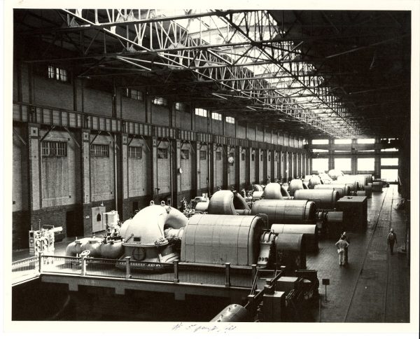
Headquartered in downtown Milwaukee’s PUBLIC SERVICE BUILDING, We Energies is Wisconsin’s largest electric and natural gas utility. The publicly-traded company serves eastern Wisconsin and Michigan’s Upper Peninsula. A subsidiary of parent company WEC Energy Group, We Energies’ 21st-century portfolio includes coal, natural gas, nuclear, oil, and renewable energies. The firm dates back to THE MILWAUKEE…
Read More
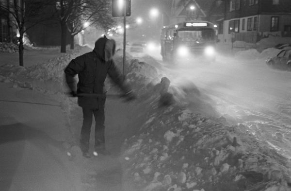
Author: C. J. Hribal
Milwaukeeans love to boast about their weather almost as much as they love to complain about it. I’m reminded of an old song by John Martyn, “Bless the Weather.” It’s a love song of lament—the refrain noting that what the weather giveth, the weather taketh away: “Bless the weather that brought you to me//Curse the…
Read More
Author: Bill Reck
The Milwaukee area’s Welsh population generally left their homes in Wales in southwestern Great Britain in the mid-nineteenth century due to the paucity of available land for farming. There is evidence that many people in Wales were aware of the 1841 American preemption laws, which allowed for the purchase of 160 acres for $1.25 per…
Read More
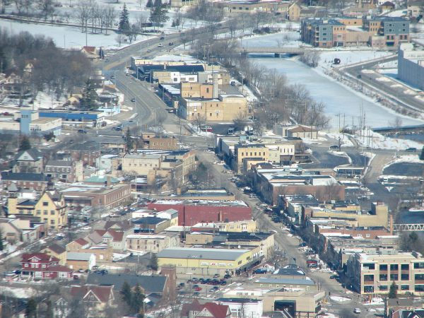
Author: Niles Niemuth
The city of West Bend, the seat of Washington County, is located at the point where the Milwaukee River turns due east and flows into Ozaukee County. The area was settled by Euopean and American migrants in the 1840s and was incorporated as city in 1885. After its incorporation, West Bend transformed from a local…
Read More
Author: Karen Hayward
The Village of West Milwaukee occupies about one square mile, roughly between 38th and 56th Street and from National to Lincoln Avenue. It is surrounded by the CLEMENT J. ZABLOCKI VA MEDICAL CENTER grounds on the north, MILWAUKEE on the south and east, and West Allis to the west. Potawatomi lived in the area until…
Read More
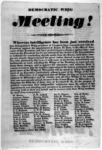
Author: Karalee Surface
This political party’s influence in Milwaukee, first apparent in the late 1830s, was circumscribed because of the city’s substantial foreign-born population. German and Irish voters tended to align themselves with the Democratic Party against the Yankee-dominated Whigs, who were seen as nativists and temperance advocates. Over the course of the 1840s and 1850s, Milwaukee Whigs…
Read More
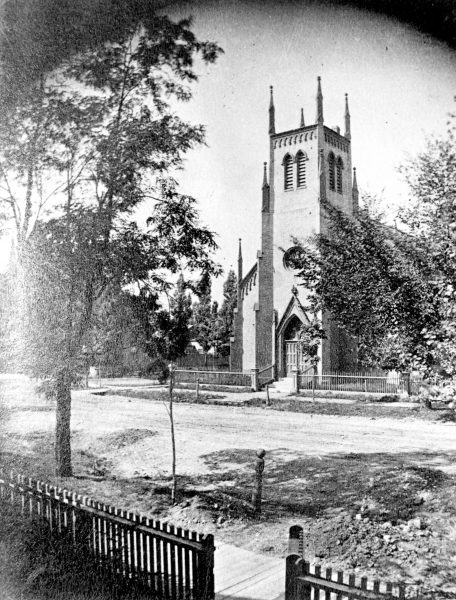
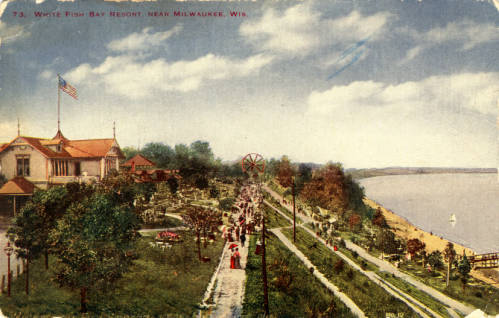
Author: Thomas H. Fehring
The Village of Whitefish Bay is located about five miles north of downtown Milwaukee on the bluffs above Lake Michigan. It is primarily residential, with a retail shopping area along Silver Spring Drive. When settlers began moving into the area in the mid-nineteenth century, the area was much different. Like other early Milwaukee settlements, it…
Read More
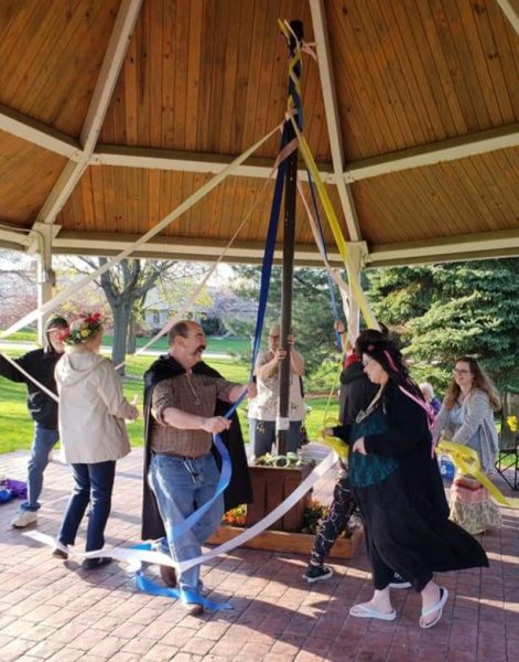
Author: Jenna Jacobs
Wiccans, some of whom self-identify as witches, and other Pagans are a small but growing presence within the United States. Many Wiccans practice their faith individually or in small groups. Although estimates of the number of Wiccans are unreliable, a 2014 Pew Research Center survey found that roughly 0.3% of Americans identified as Wiccans or…
Read More
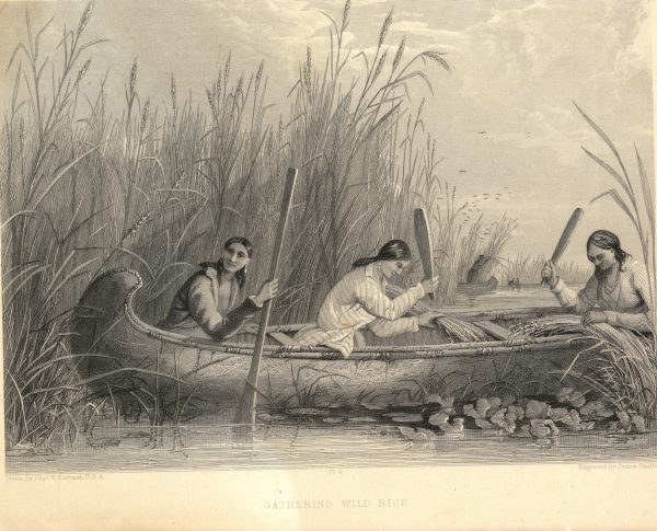
Author: Marlo Buser
Wild rice was and is a staple food crop for the Native American tribes of Wisconsin. Indeed, the Menominee, one of the major tribes in the Milwaukee area, were called “the Wild Rice People” by Europeans. Traditionally grown in shallows at the edges of lakes and ponds, wild rice is harvested in the fall by…
Read More
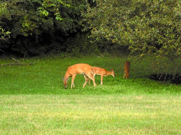
Author: Michael Pulido
The history of wildlife in the Milwaukee region is the story of the complex relationships between animals, humans, and the built and natural environments. The region is defined here by the four human-defined counties that encompass the Milwaukee River Basin and its three rivers, the Milwaukee, Menomonee, and Kinnickinnic. To the east is the shoreline…
Read More