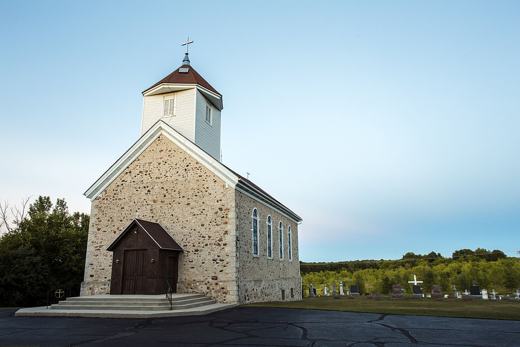
The Town of Trenton is located on the eastern edge of Washington County and originally occupied a six-mile square, or thirty-six square miles of land. This land area diminished after an extensive series of annexations by the neighboring Town of West Bend, the construction of the West Bend Municipal Airport, and the incorporation of the Village of Newburg (which was originally a hamlet located within the original Town limits).[1] In 2010, the Town occupied 32.83 square miles.[2]
Established on March 11, 1848, the Town of Trenton attracted white settlers more than a decade earlier, upon the regional completion of the U.S. Public Land Survey.[3] In 1836, the City of Milwaukee’s first mayor and co-founder Solomon Juneau and other land speculators started purchasing land in the Town of Trenton; Juneau’s property lay along the Milwaukee River. By the mid-1840s, settlement concentrated in the hamlet of Newburg, located in the eastern part of the Town. A sawmill, a gristmill, and a dam, all built in the late 1840s, harnessed the power of the Milwaukee River.[4] This infrastructure and the resulting opportunities for trade and commerce attracted residents to the little hamlet, which was officially incorporated as the Village of Newburg in 1973.[5] A second hamlet, Myra, grew in the central part of the Town, along another bend in the Milwaukee River. By 1881, the two urban centers housed post offices that served the Town of Trenton.[6] Myra remains an unincorporated community within the Town of Trenton in the 21st century.[7]
Between 1845 and 1848, migrants from the eastern United States occupied nearly all the available farmland in Trenton. By the early 1880s, most residents of the Town were German immigrants and their children.[8] Much of the dense forest that early settlers met was cleared by the late nineteenth century, and the principal industry in the area became farming. The local economy also relied on cattle and dairy farming; a large cheese factory was located in the western part of the Town.[9]
The Milwaukee River roughly bisects the Town of Trenton today. State Trunk Highway 33, an east-west thoroughfare that links residents to the larger urban area of West Bend, follows the path of the Milwaukee River through the Town of Trenton. The area also includes an abundance of small lakes and ponds, as well as the North Branch of Cedar Creek.[10]
Serving as a bedroom community, by the end of the twentieth century nearly half of all residents in the Town of Trenton traveled outside of Washington County to get to their place of work. Most late twentieth century residential growth added single family homes; the Town issued 321 building permits, exclusively for single-family homes, during the period from 1980 to 1994.[11] The Town of Trenton has seen moderate growth since the end of the twentieth century, growing from 3,967 residents in 1990 to 4,732 in 2010.[12]
Footnotes [+]
- ^ Southeastern Wisconsin Regional Planning Commission, A Land Use Plan for the Town of Trenton: 2010 (Waukesha, WI: Southeastern Wisconsin Regional Planning Committee, 1997), 1; Western Historical Company, History of Washington and Ozaukee Counties, Wisconsin (Chicago, IL: Western Historical Company, 1881), 443.
- ^ U.S. Census Bureau, 2010 Census of Population and Housing, Population and Housing Unit Counts, CPH-2-51, Wisconsin (Washington, DC: U.S. Government Printing Office, 2012), 40.
- ^ According to Brenda Hemstead, PLLS Origins in Wisconsin, Wisconsin State Cartographer’s website, last accessed September 3, 2017, the U.S. Public Land Survey was begun by Federal Government in 1785. The project sought to establish legal land divisions in an effort to facilitate the transfer of lands from the Public Domain to private property owners. In Wisconsin, the survey was carried out from 1832 until 1866. For an explanation of the Public Land Survey System in the State of Wisconsin, see Tutorial on the Public Land Survey System Descriptions, Wisconsin Department of Natural Resource’s website, last accessed September 3, 2017.
- ^ Southeastern Wisconsin Regional Planning Commission, A Land Use Plan for the Town of Trenton: 2010 (Waukesha, WI: Southeastern Wisconsin Regional Planning Committee, 1997), 1-3.
- ^ “Newburg: A New Village,” The Milwaukee Journal, January 2, 1974.
- ^ Western Historical Company, History of Washington and Ozaukee Counties, Wisconsin (Chicago, IL: Western Historical Company, 1881), 445.
- ^ James Esselman and Leonard Casper, Town of Trenton & Village of Newburg, 1776-1976 (Wisconsin: n.p., 1976), 9-13.
- ^ Western Historical Company, History of Washington and Ozaukee Counties, 443; Southeastern Wisconsin Regional Planning Commission, A Land Use Plan for the Town of Trenton, 3.
- ^ Western Historical Company, History of Washington and Ozaukee Counties, 445.
- ^ Southeastern Wisconsin Regional Planning Commission, A Land Use Plan for the Town of Trenton, 6.
- ^ Southeastern Wisconsin Regional Planning Commission, A Land Use Plan for the Town of Trenton, 21-22.
- ^ U.S. Census Bureau, 2010 Census of Population and Housing, Population and Housing Unit Counts, CPH-2-51, Wisconsin (Washington, DC: U.S. Government Printing Office, 2012), 96.
For Further Reading
Esselman, James, and Leonard Casper. Town of Trenton & Village of Newburg, 1776-1967. Wisconsin: n.p., 1976.

0 Comments
Please keep your community civil. All comments must follow the Encyclopedia of Milwaukee Community rules and terms of use, and will be moderated prior to posting. Encyclopedia of Milwaukee reserves the right to use the comments we receive, in whole or in part, and to use the commenter's name and location, in any medium. See also the Copyright, Privacy, and Terms & Conditions.
Have a suggestion for a new topic? Please use the Site Contact Form.