Showing 601-620 of 683 Entries
Author: Genevieve G. McBride
Vel Phillips (1924-2018), Milwaukee’s first alderwoman and the first African American on its Common Council, was born Velvalea Rodgers on the South Side of Milwaukee. While she was a child, her family moved to Bronzeville, where she later established her political career. She graduated from Howard University in 1946, returned to Wisconsin to attend law school…
Read More
Author: James Marten
The most remarkable reminder of the presence of veterans in Milwaukee is the Milwaukee County War Memorial Center (WMC), which was built on the downtown lakefront as a “living memorial” to veterans. Finished in 1957, the War Memorial building is the home of the Milwaukee Art Museum, while the non-profit organization that administers the WMC…
Read More
Author: Kathleen Kean
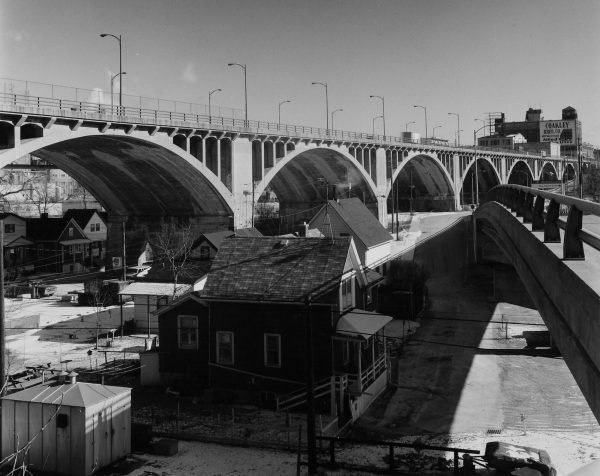
Milwaukee’s topography of rivers, valleys, and high bluffs created significant transportation challenges. Engineers in Milwaukee constructed bridges to allow vehicles and pedestrians to cross over waterways, while viaducts directed traffic across changes in terrain. During the late nineteenth century, innovations in iron and steel construction allowed viaducts to cover greater distances with multiple spans and…
Read More
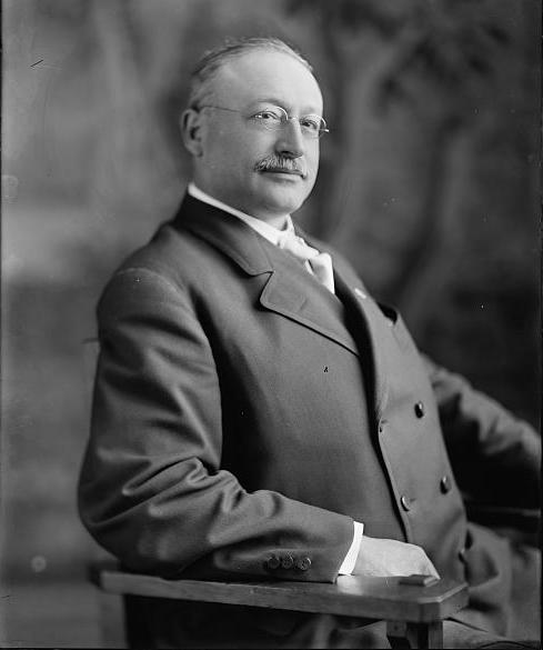
Author: Michael E. Stevens
Newspaperman, co-founder of the Socialist Party, and first Socialist U.S. Congressman, Victor L. Berger (1860-1929) created the party apparatus that shaped Milwaukee politics for a half century. Berger fought for free speech, opposed war, and advocated for programs ranging from old-age pensions to Milwaukee’s public parks. Berger believed that change would come through evolution and…
Read More
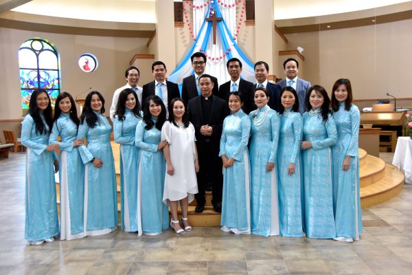
Author: Brian Mueller
Vietnamese refugees arrived in Milwaukee in several “waves” during and after the Vietnam War. In the years following, the Vietnamese who arrived in Milwaukee assimilated into American society. “First wave” refugees, with medical educations and middle- or upper-class backgrounds, came to America before 1975. These refugees used their connections to former American military officers they…
Read More
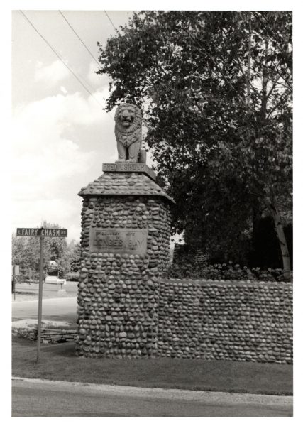
Author: Jenna Jacobs
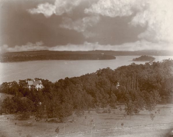
Located along LAKE MICHIGAN, about twelve miles north of downtown MILWAUKEE, the Village of Bayside occupies the northern end of MILWAUKEE COUNTY’s lakeshore and extends into OZAUKEE COUNTY. The Village had a population of 4,389 in 2010 and a median estimated home value of $325,600 in 2014. An AGRICULTURAL and summer home region in the…
Read More
Author: Jenna Jacobs
The Village of Big Bend is located along the Fox River within the Town of Vernon, southwest of MILWAUKEE. Like much of WAUKESHA COUNTY, Big Bend and Vernon began as farming communities. The Town of Vernon was founded in 1839, while the Village of Big Bend was incorporated out of Vernon’s land in 1928. In…
Read More
Author: Jenna Jacobs
Located in northern MILWAUKEE COUNTY, the suburban village of Brown Deer is bordered on the west and south by the CITY OF MILWAUKEE. With an area of 4.5 square miles and a 2010 population of 11,999, Brown Deer is sometimes seen as a bridge between the city and the other North Shore suburbs of SHOREWOOD,…
Read More
Author: Michele Saltzman
The Village of Butler lies on WAUKESHA COUNTY’S eastern border, surrounded by Menomonee Falls, Brookfield, and Milwaukee. The small, industrial village owes its existence to the railroad industry. In the twenty-first century, residents continue to celebrate that connection. In 1909, the Milwaukee, Sparta, and North Western Railway built a railroad yard on Milwaukee’s 124th St. border…
Read More
Author: Niles Niemuth
The Village of Chenequa is centered on Pine Lake in the LAKE COUNTRY area of WAUKESHA COUNTY, approximately 30 miles west of the city of Milwaukee. In 2010 Chenequa’s population was estimated to be 590. The Potawatomi were the last native peoples known to have inhabited the area, with villages established on the eastern and…
Read More
Author: Michele Saltzman
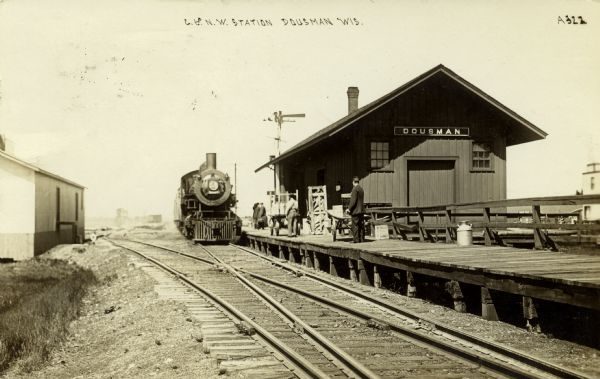
Dousman is a small village located about 35 miles west of Milwaukee in Waukesha County’s “Lake Country.” It was named after Talbot C. Dousman, a prominent local politician who settled there in in the mid-1830s. Historically a popular location for summer visitors to the Lake Country, Dousman was the most important community center in the…
Read More
Author: James K. Nelsen
The Village of Elm Grove is a community of about six thousand people in eastern Waukesha County. It borders the Village of Wauwatosa to the east and the City of Brookfield in all other directions. It was part of the Town of Brookfield until 1955. It is governed by a seven-member volunteer board. All trustees,…
Read More
Author: James K. Nelsen
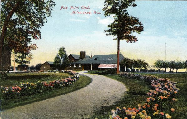
Fox Point is a suburb of Milwaukee. It is located on the North Shore, east of Milwaukee along Lake Michigan, and was incorporated as a village in 1926. As a village, it does not have full-time elected officials. Rather, it has a village board that consists of a president and six trustees. They serve three-year…
Read More
Author: Jenna Jacobs
The Village of Grafton, located twenty miles north of Milwaukee in OZAUKEE COUNTY, is centered on the Milwaukee River. The village is bordered by the City and Town of Cedarburg to the west and the TOWN OF GRAFTON to the east. In 1896, the Village of Grafton was incorporated from the Town of Grafton. When…
Read More
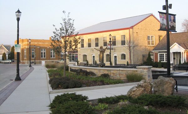
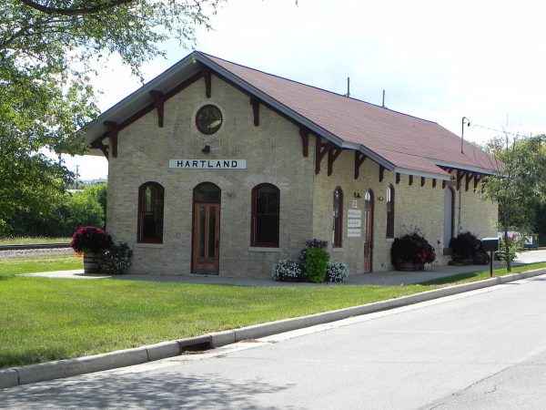
Author: Niles Niemuth
According to legend, in 1838 Stephen Warren, the first white settler of the Hartland area, walked from the city of Ann Arbor in Michigan to the WAUKESHA area in search of desirable farm land. Warren established a farmstead where his family joined him. The Warren family was followed by native-born migrants in addition to Swedish,…
Read More
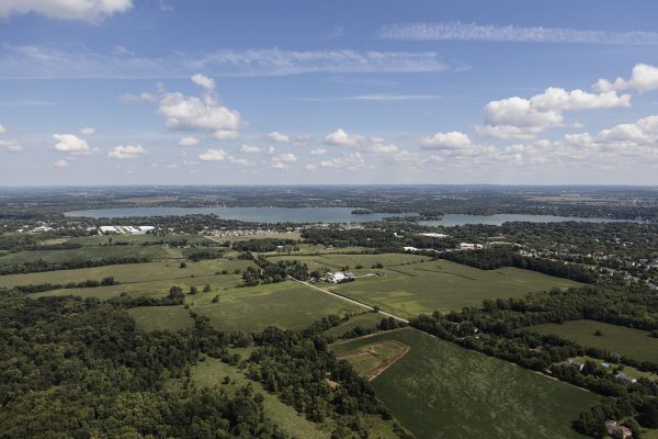
Author: Michele Saltzman
The Village of Lac La Belle is a small, affluent community located about 38 miles west of Milwaukee along three miles of Lac La Belle, one of WAUKESHA COUNTY’S biggest lakes. With only 289 residents as of 2010, Lac La Belle is the least populated village in the county. It is located almost entirely within…
Read More
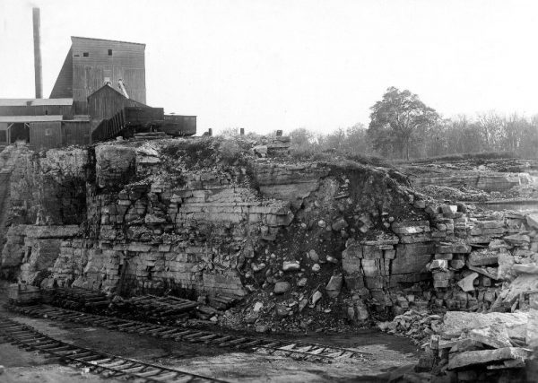
Author: Niles Niemuth
The Village of Lannon is a small community in northeastern WAUKESHA COUNTY incorporated in 1930. As of the 2010 census the village had a population of 1,107. Lannon is located on the Niagara Escarpment, a geographic feature that stretches across the Great Lakes region and contains a significant amount of limestone. The first limestone quarry…
Read More
Author: Michele Saltzman
The Village of Lisbon is a rural community of approximately 10,000 residents spread out over 27 square miles. It is about 25 miles northwest of Milwaukee in WAUKESHA COUNTY. The first families to settle the area were the English Redfords and Weavers, who arrived in the mid-1830s. After 1838, when Lisbon became an official Town,…
Read More
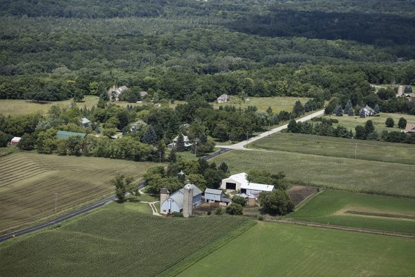
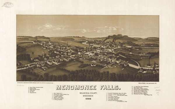
Author: William I. Tchakirides
Home to roughly 36,000 residents in 2010, Menomonee Falls is Wisconsin’s most populous village. Located approximately fifteen miles northwest of Milwaukee in WAUKESHA COUNTY, the settlement was named for the Menomonee River, a tributary of the MILWAUKEE RIVER. Native Menomonee people inhabited the area before white settlement, which began in earnest after 1840; the village…
Read More
Authors: Michele Saltzman and Jenna Jacobs
The Village of Nashotah is located about forty miles northwest of MILWAUKEE in WAUKESHA COUNTY’s LAKE COUNTRY. The Village’s name comes from a Native American term meaning “twins.” Nashotah is named for the nearby Upper and Lower Nashotah Lakes, although the lakes themselves are not within the Village. The Village does border Lake Nagawicka and…
Read More